
|
|
|
Thank you for visiting
Applied Geo-Imaging Solutions, Inc.
Remote sensing technology can help you reduce the risk of groundwater contamination by improving field inspections for maintenance and repair. We provide training and experienced consultation in technologies that manage custodial care and control costs.
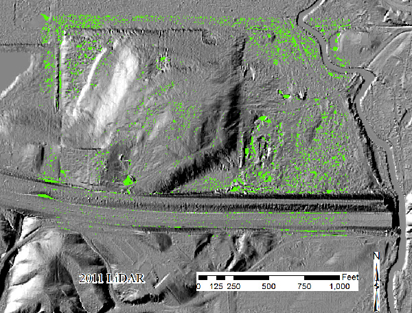
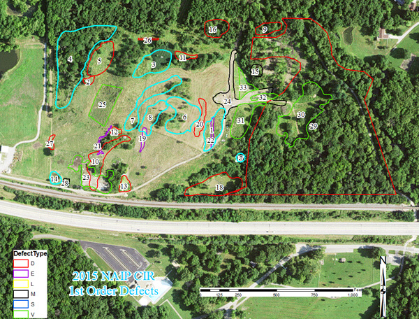
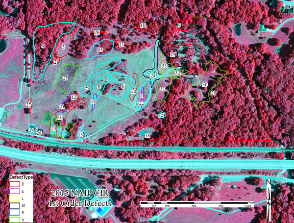
One of our services is the creation of annotated aerial photos which guide field inspectors to defects that are tracked in a geodatabase for onsite and offsite consultation. Remote sensing technology reveals hidden defects and provides quantitative information not easily measured.
Move your mouse over the MENU button in the upper right hand corner and the list of links will pop up. See our updates under SERVICES & ABOUT us.
Welcome to AGIS.
Please contact us by phone or email if you have questions on how we can assist you with remote sensing needs. Keep checking back as we continue to update the website and watch for news where we will be to meet us in person.
Thank You.
Meetings and Presentations 2018
Congresso Argentino de Cuaternario y Geomorfologia (Argentine Congress of Quaternary and Geomorphology) September 18-21, 2018 at Puerto Madryn, Argentina. Preceding the meeting Chris will work with renowned geomorphologist and climate scientist Dr. Jorge Rabassa on several critical facilities problems facing Ushuaia, Tierra del Fuego, Patagonia, Argentina particularly the municipal landfill which is experiencing a problem both of increasing volume (from cruise ships) and threat to water resources.
Meetings and Presentations 2017
ōAttending the 25th Annual ILCSWMA conference.ö October 26th and 27th, 2017 Springfield, Illinois
ōOrigins of Early Landfill Studies in Illinois and Development of a Low-Cost Monitoring of Closed Landfills by Remote Sensing,ö Joint Meeting of Illinois Groundwater Association and Illinois Association of Groundwater Professionals, February 10, 2017 Peoria, IL.
ōEarly Landfill Studies and the Development of a Low-Cost Monitoring of Closed Landfills by Remote Sensing,ö University of Akron, March 9, 2017, Akron, OH
ōLandfill Studies, IllinoisÆ Legacy Landfills, Development of a Low-Cost Monitoring of Closed Landfills by Remote Sensing, and Implications for Groundwater Resources,ö
Illinois Association of Groundwater Professionals Training Program, March 17, 2017, Mt. Vernon, IL.
ōIllinoisÆ Legacy Landfills, and Implications for Groundwater Resources,ö Air & Waste Management Association (Lake Michigan Section). May 16, 2017, Union League Club, Chicago, IL.
ōIllinoisÆ and Vermilion County Legacy Landfills, and Implications for Groundwater Resourcesö Vermilion County Health Department, June 27, 2017, Danville, IL.
ōAssessing the Potential for Groundwater Contamination From IllinoisÆ Landfills Using Remote Sensing and GIS Technologyö Association of Environmental and Engineering Geologists Annual Meeting, Colorado Springs, CO September 12-16, 2017.

|

|